
Volunteers add another tool in fight against buckthorn
News | Published on March 20, 2023 at 2:19pm CDT
By John R. Stone
Reporter
Can a volunteer group accurately map locations of an invasive species infestations in 250 aces of Barsness Park?
That’s what will be figured out later this spring when a group of volunteers evaluates the level of buckthorn infestation at hundreds of specific waypoints in Barsness Park.
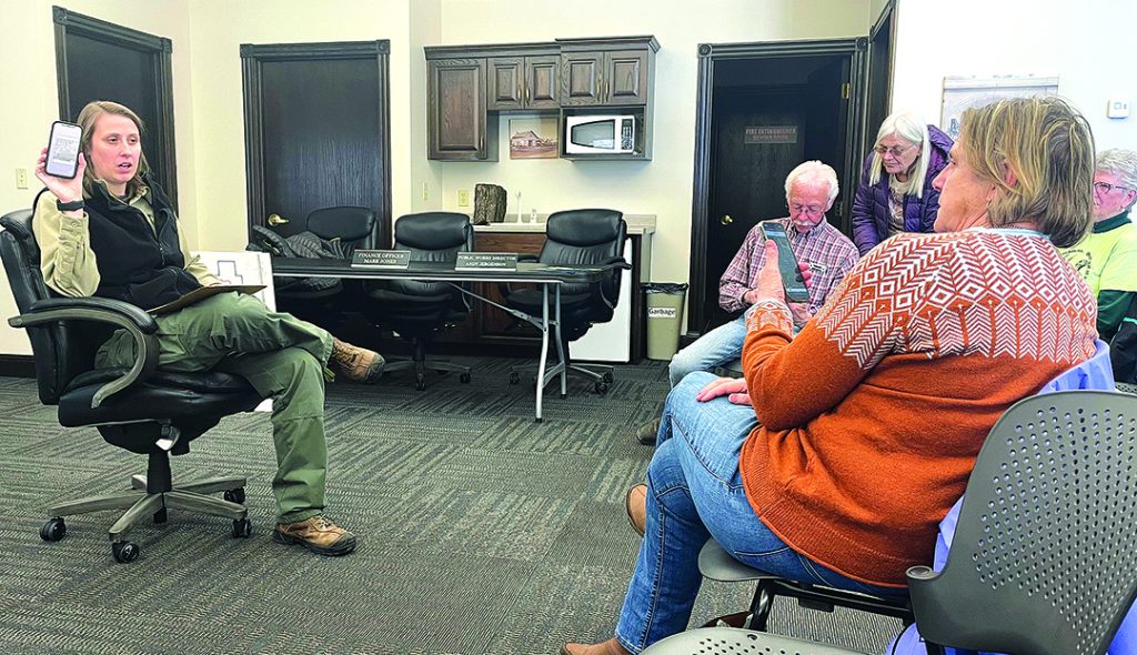
Kylee Berger, a forester with the Minnesota Department of Natural Resources, showed volunteers last week how to use a smart phone app to record data on those waypoints later this spring when buckthorn leaves start to come out.
First the app had to be loaded onto phones and Berger led the 18 volunteers through that process and then gave some lessons and testing in using the app to load data.
The waypoints are spots on a map of Barsness Park. They are arranged in a square pattern. A person can track his or her location on a smart phone using the Avenza Maps app.
When the person lines up exactly in the correct spot as shown by a dot on the app’s map on the smart phone, the person is in the center of a 30-foot circle. He or she then looks for buckthorn over a 360 degree area 15 feet from where the person is standing. If there is none, that gets recorded. If there is a heavy concentration, that is recorded as it would be if there were a moderate concentration. Also noted is the type of terrain, height of the infestation, accessibility to the spot for possible treatment, and an opinion of the best management technique.
This data is then loaded into the smart phone for that particular spot, which has its own number. A picture can also be taken and added to the data package for that spot. Then the observer can move to the next spot.
This data would then be sent to Berger who would place the data onto the overall map which should give a picture of where buckthorn is located in the park, how dense it is in different spots, where treated areas are and what methods might be best for controlling the invasive species.
Berger said that this is the first time she has tried this with a group and was interested in seeing how it worked out.
Wayne Zimmerman, the Buckthorn Brigade leader, explained that different types of land had different treatment options. Hills and marshy areas were probably best treated using goats, flat and drier land can be treated with forest mulchers or, in some areas, chemicals that are safe to use around water. Small isolated areas can be trimmed back by crews of two or three people with loppers or chain saws.
Zimmerman said the value in the map is that over the years it can be used to schedule maintenance in terms of controlling buckthorn and also serve as an evaluation of what methods of treatment seem to be working the best. It could then be updated every few years, he said.